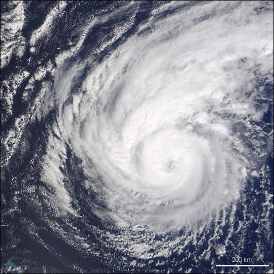
Strong El Niño conditions, with a very strong phase now likely through the Atlantic peak months of August-October, continue to drive elevated vertical wind shear across the Main Development Region, suppressing tropical cyclone formation and intensification despite slightly above-average sea surface temperatures. As of August 24, 2026, the Atlantic basin has recorded just three named storms—Arthur, Bertha, and Cristobal—all remaining below hurricane strength, yielding the lowest accumulated cyclone energy in decades and zero U.S. landfalls to date. NOAA’s August 6 update maintains a 75% probability of a below-normal season overall (7-13 named storms, 2-6 hurricanes, 0-2 major hurricanes), consistent with historical analogs under strong El Niño. Traders should watch for any late-August or early-September tropical waves, NHC 7-day outlooks, and updated dynamical model runs that could signal brief windows of reduced shear tied to the Madden-Julian Oscillation; landfall probabilities remain low until steering patterns and storm tracks become predictable within days of potential impacts.
Experimental AI-generated summary referencing Polymarket data. This is not trading advice and plays no role in how this market resolves. · UpdatedWhere will a hurricane make landfall in the US during the 2026 hurricane season?
Where will a hurricane make landfall in the US during the 2026 hurricane season?
$12,242 Vol.
Texas
11%
Louisiana
13%
Mississippi
9%
Alabama
7%
Florida
39%
Georgia
9%
South Carolina
11%
North Carolina
16%
Virginia
6%
Maryland
8%
Delaware
11%
New Jersey
10%
New York
29%
Connecticut
3%
Rhode Island
9%
Massachusetts
9%
New Hampshire
9%
Maine
8%
Hawaii
12%
$12,242 Vol.
Texas
11%
Louisiana
13%
Mississippi
9%
Alabama
7%
Florida
39%
Georgia
9%
South Carolina
11%
North Carolina
16%
Virginia
6%
Maryland
8%
Delaware
11%
New Jersey
10%
New York
29%
Connecticut
3%
Rhode Island
9%
Massachusetts
9%
New Hampshire
9%
Maine
8%
Hawaii
12%
A hurricane landfall is said to occur when a hurricane's surface center intersects with the coastline (https://www.nhc.noaa.gov/aboutgloss.shtml#LANDFALL) and the NHC reports maximum sustained winds of 74 mph or higher (Category 1 or greater) at the time of landfall. The state of landfall is determined by the surface center's location when it crosses the coastline. If a single hurricane makes separate landfalls in more than one listed state, each such state resolves to "Yes".
Hurricane season runs from June 1, 2026 - November 30, 2026.
Each market resolves based on the initial NHC (or CPHC) advisory reporting a qualifying landfall in the relevant state, regardless of any later retraction or reanalysis. Each market may only resolve to "No" after November 30, 2026, 11:59 PM ET, or, if an extension period applies, after December 7, 2026, 11:59 PM ET, if the conditions for a "Yes" resolution have not been met.
If an active tropical cyclone at hurricane strength is over water per official NHC or CPHC advisories as of 11:59 PM ET on November 30, 2026, the relevant market(s) will operate under an extension period of 7 days, and the resolution date will move to December 7, 2026, 11:59 PM ET; a qualifying landfall by that hurricane during the extension period will count toward resolution.
If a qualifying landfall occurs within a market's timeframe (including any extension period) but has not yet been confirmed by an NHC or CPHC advisory by the resolution date, that market will remain open until such an advisory is issued.
Market Opened: Aug 18, 2026, 4:30 PM ET
Resolution Source
https://www.nhc.noaa.gov/Resolver
0x65070BE91...A hurricane landfall is said to occur when a hurricane's surface center intersects with the coastline (https://www.nhc.noaa.gov/aboutgloss.shtml#LANDFALL) and the NHC reports maximum sustained winds of 74 mph or higher (Category 1 or greater) at the time of landfall. The state of landfall is determined by the surface center's location when it crosses the coastline. If a single hurricane makes separate landfalls in more than one listed state, each such state resolves to "Yes".
Hurricane season runs from June 1, 2026 - November 30, 2026.
Each market resolves based on the initial NHC (or CPHC) advisory reporting a qualifying landfall in the relevant state, regardless of any later retraction or reanalysis. Each market may only resolve to "No" after November 30, 2026, 11:59 PM ET, or, if an extension period applies, after December 7, 2026, 11:59 PM ET, if the conditions for a "Yes" resolution have not been met.
If an active tropical cyclone at hurricane strength is over water per official NHC or CPHC advisories as of 11:59 PM ET on November 30, 2026, the relevant market(s) will operate under an extension period of 7 days, and the resolution date will move to December 7, 2026, 11:59 PM ET; a qualifying landfall by that hurricane during the extension period will count toward resolution.
If a qualifying landfall occurs within a market's timeframe (including any extension period) but has not yet been confirmed by an NHC or CPHC advisory by the resolution date, that market will remain open until such an advisory is issued.
Resolution Source
https://www.nhc.noaa.gov/Resolver
0x65070BE91...Strong El Niño conditions, with a very strong phase now likely through the Atlantic peak months of August-October, continue to drive elevated vertical wind shear across the Main Development Region, suppressing tropical cyclone formation and intensification despite slightly above-average sea surface temperatures. As of August 24, 2026, the Atlantic basin has recorded just three named storms—Arthur, Bertha, and Cristobal—all remaining below hurricane strength, yielding the lowest accumulated cyclone energy in decades and zero U.S. landfalls to date. NOAA’s August 6 update maintains a 75% probability of a below-normal season overall (7-13 named storms, 2-6 hurricanes, 0-2 major hurricanes), consistent with historical analogs under strong El Niño. Traders should watch for any late-August or early-September tropical waves, NHC 7-day outlooks, and updated dynamical model runs that could signal brief windows of reduced shear tied to the Madden-Julian Oscillation; landfall probabilities remain low until steering patterns and storm tracks become predictable within days of potential impacts.
Experimental AI-generated summary referencing Polymarket data. This is not trading advice and plays no role in how this market resolves. · Updated


Beware of external links.
Beware of external links.
Frequently Asked Questions