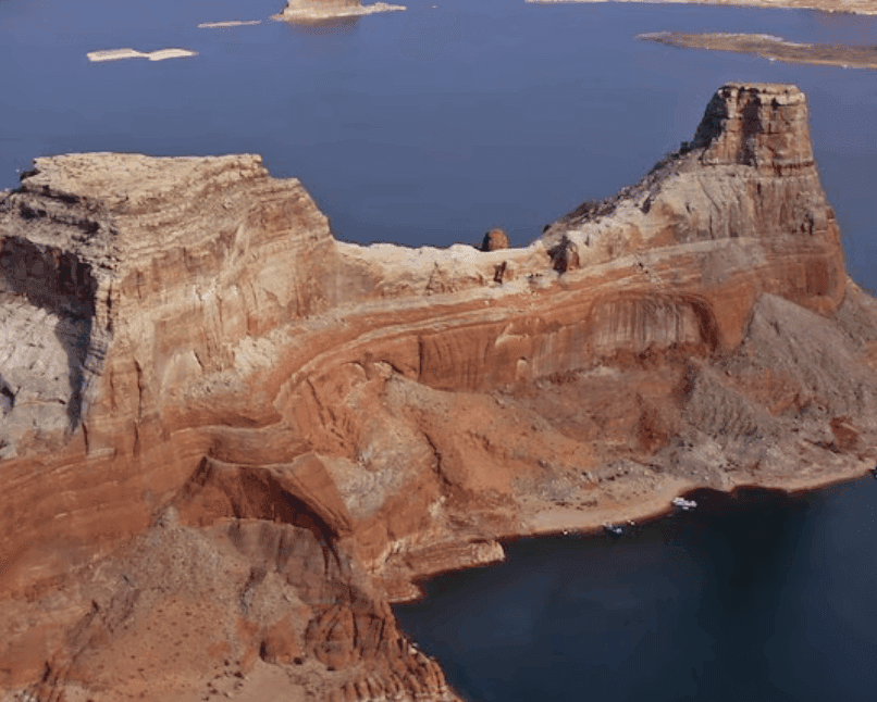
Current Lake Powell elevation stands at approximately 3,518 ft amid ongoing basin-wide drought, with water year 2026 unregulated inflows forecast at just 37% of average by the Colorado Basin River Forecast Center. This stems from below-normal precipitation and snowpack across the Upper Colorado River watershed, limiting natural refill while Glen Canyon Dam releases are capped at 6 million acre-feet under updated Interim Guidelines to protect infrastructure. U.S. Bureau of Reclamation 24-month studies project a decline toward 3,507–3,515 ft by December 2026, with operations shifting into the Low Elevation Infrastructure Protection Range below 3,510 ft in water year 2027 and supplemental upstream releases from Flaming Gorge under the Drought Response Operations Agreement providing a partial buffer. These factors underpin trader consensus around the 3,510 ft threshold amid model uncertainty in late-summer monsoon contributions and 2027 hydrology.
Experimental AI-generated summary referencing Polymarket data. This is not trading advice and plays no role in how this market resolves. · UpdatedHow low will Lake Powell drop?
How low will Lake Powell drop?
Above 3,510 ft 50%
3,500–3,510 ft 25%
3,490–3,500 ft 21%
Below 3,490 ft 6%
Above 3,510 ft
50%
3,500–3,510 ft
25%
3,490–3,500 ft
21%
Below 3,490 ft
6%
Above 3,510 ft 50%
3,500–3,510 ft 25%
3,490–3,500 ft 21%
Below 3,490 ft 6%
Above 3,510 ft
50%
3,500–3,510 ft
25%
3,490–3,500 ft
21%
Below 3,490 ft
6%
Resolution is determined by the lowest daily elevation recorded at Lake Powell (Glen Canyon Dam, USBR site) between market creation and March 31, 2027. Because a lower reading can occur at any point up to March 31, 2027, all outcomes are settled after the window closes, based on the lowest daily elevation recorded during the window.
The resolution source is the minimum daily lake elevation published by the U.S. Bureau of Reclamation for Lake Powell at Glen Canyon Dam, available at https://data.usbr.gov/catalog/2362/item/508. USBR data is provisional and subject to revision; the lowest daily elevation reflected in USBR data as of April 15, 2027 governs, and revisions published after April 15, 2027 will not change the outcome. Daily elevation data published at https://lakepowell.water-data.com/ may also be referenced, but if it disagrees with USBR, the USBR value governs.
Market Opened: Aug 17, 2026, 5:49 PM ET
Resolution Source
https://data.usbr.gov/catalog/2362/item/508Resolver
0x69c47De9D...Resolution is determined by the lowest daily elevation recorded at Lake Powell (Glen Canyon Dam, USBR site) between market creation and March 31, 2027. Because a lower reading can occur at any point up to March 31, 2027, all outcomes are settled after the window closes, based on the lowest daily elevation recorded during the window.
The resolution source is the minimum daily lake elevation published by the U.S. Bureau of Reclamation for Lake Powell at Glen Canyon Dam, available at https://data.usbr.gov/catalog/2362/item/508. USBR data is provisional and subject to revision; the lowest daily elevation reflected in USBR data as of April 15, 2027 governs, and revisions published after April 15, 2027 will not change the outcome. Daily elevation data published at https://lakepowell.water-data.com/ may also be referenced, but if it disagrees with USBR, the USBR value governs.
Resolution Source
https://data.usbr.gov/catalog/2362/item/508Resolver
0x69c47De9D...Current Lake Powell elevation stands at approximately 3,518 ft amid ongoing basin-wide drought, with water year 2026 unregulated inflows forecast at just 37% of average by the Colorado Basin River Forecast Center. This stems from below-normal precipitation and snowpack across the Upper Colorado River watershed, limiting natural refill while Glen Canyon Dam releases are capped at 6 million acre-feet under updated Interim Guidelines to protect infrastructure. U.S. Bureau of Reclamation 24-month studies project a decline toward 3,507–3,515 ft by December 2026, with operations shifting into the Low Elevation Infrastructure Protection Range below 3,510 ft in water year 2027 and supplemental upstream releases from Flaming Gorge under the Drought Response Operations Agreement providing a partial buffer. These factors underpin trader consensus around the 3,510 ft threshold amid model uncertainty in late-summer monsoon contributions and 2027 hydrology.
Experimental AI-generated summary referencing Polymarket data. This is not trading advice and plays no role in how this market resolves. · Updated

Beware of external links.
Beware of external links.
Frequently Asked Questions